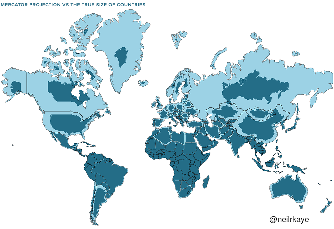
Check out the actual size of countries once the Mercator Projection, a tool developed for nautical navigation, is removed. Damn, look at northern hemispheric land masses SHRINK. Russia, Canada, Greenland, US.
One wonders in viewing these altered maps, if one hasn’t been on drugs for years or perhaps is unwittingly on them now.
This is so fundamentally MIND-BLOWING as to be almost cause for alarm. I wonder what other VISUAL DISTORTIONS we’re unaware of.